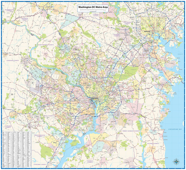
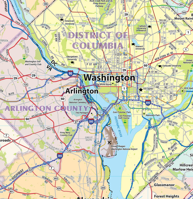
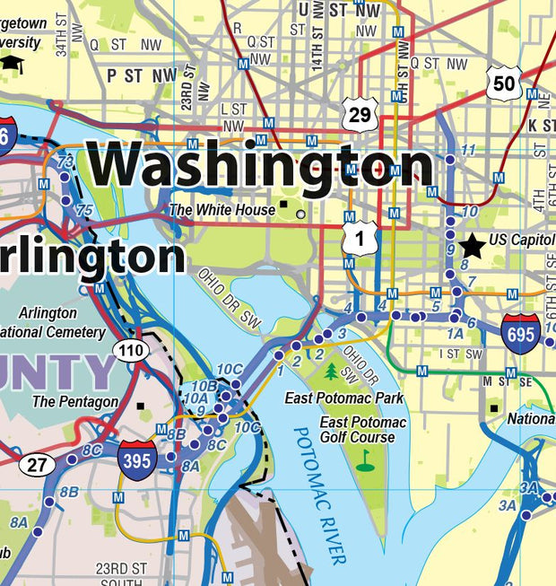
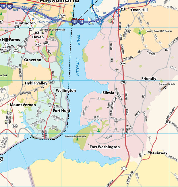
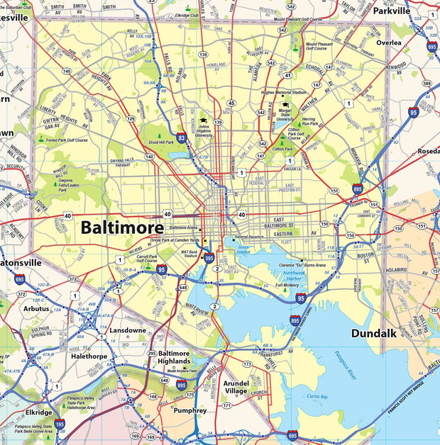
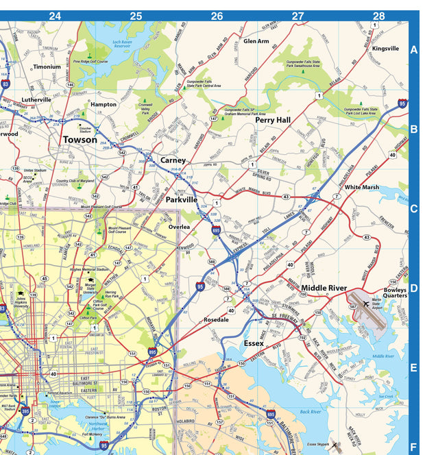
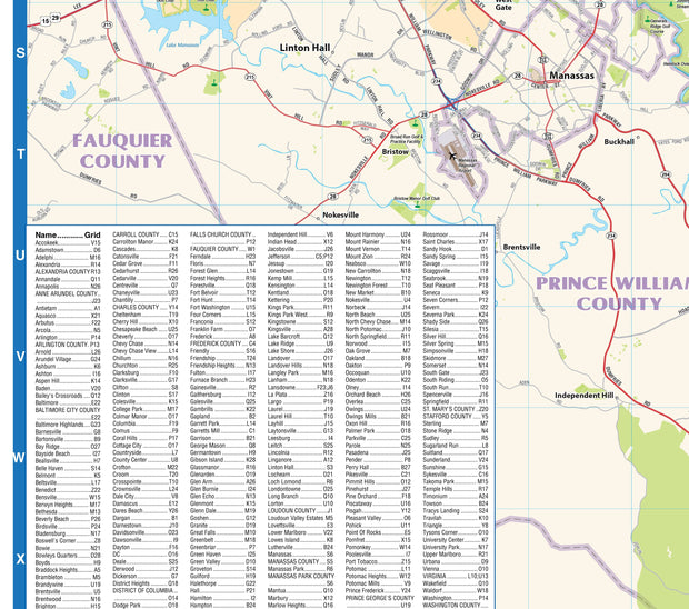
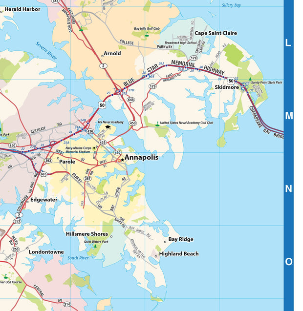
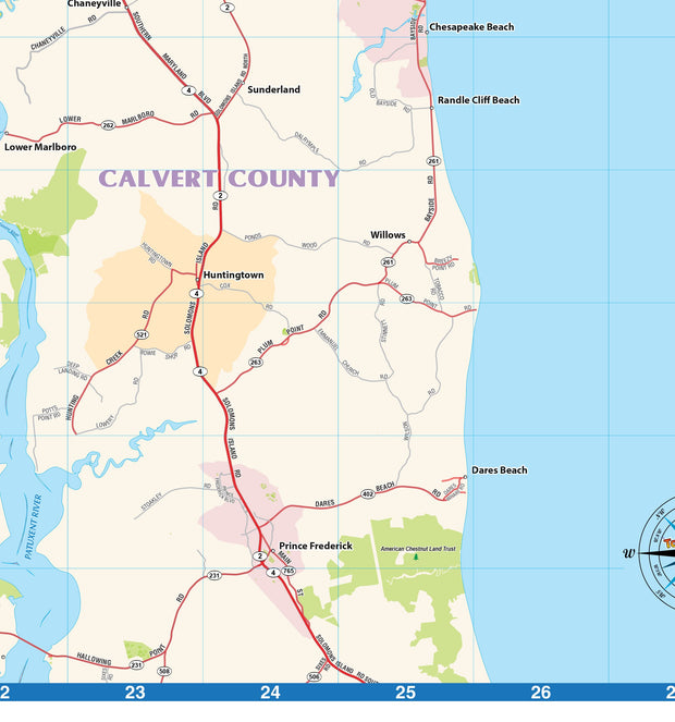
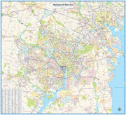
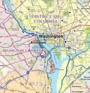
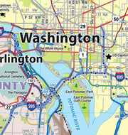
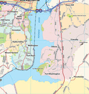
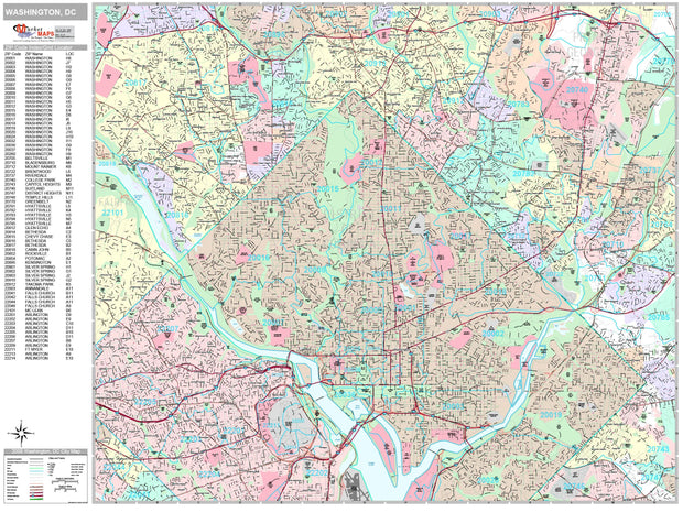
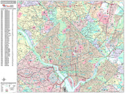
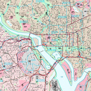
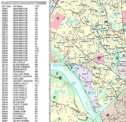
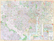
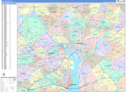
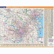
This wall map of the Washington, DC area, showing locations within 25 miles of DC. Includes much of suburban Maryland and Northern Virginia. Information shown includes counties, towns, cities, major roads and highways, and major points of interest. A community index is included.
This map is rolled and shipped in a sturdy cardboard tube.
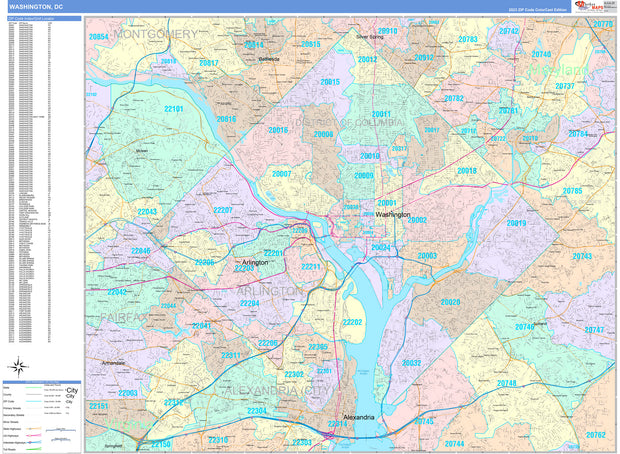
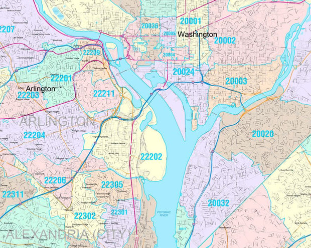
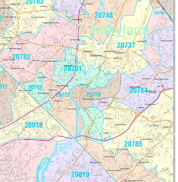
Premium Style Wall Map of Washington, DC by Market Maps
DCWM103-1
Regular price
$118.75
Save money on our full line of wall maps from one of the industry leaders in wall maps. These always up to date, eye catching wall maps come in a variety of sizes and finishing options sure to meet your specific mapping needs.
Features include:
Interstate/Us/State Highways
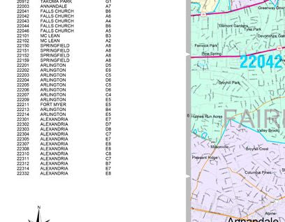
5-Digit ZIP Codes
County Names and boundaries
Cities and Towns as applicable
All water
Institutions
Cemetery
Airports
Golf Courses
Parks
Populated Places Shaded
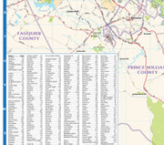
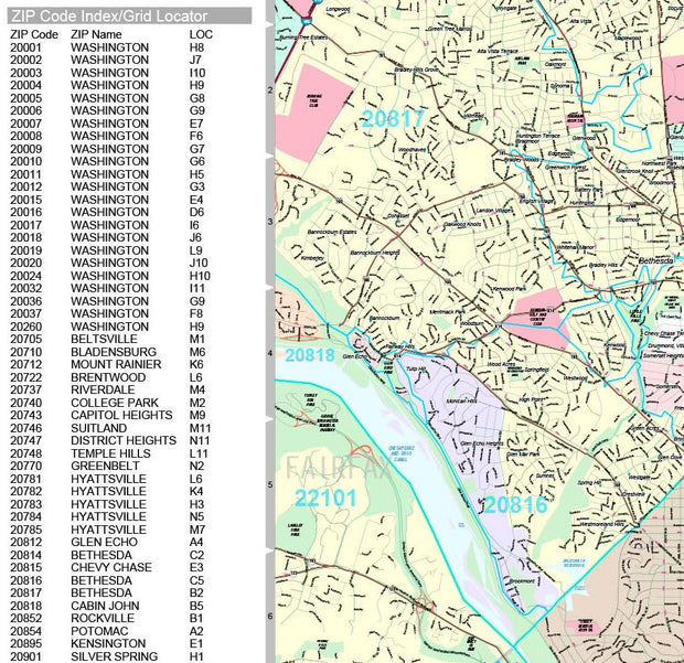
ZIP Code index with grid locator
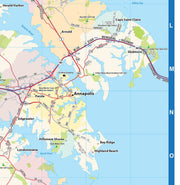
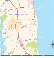
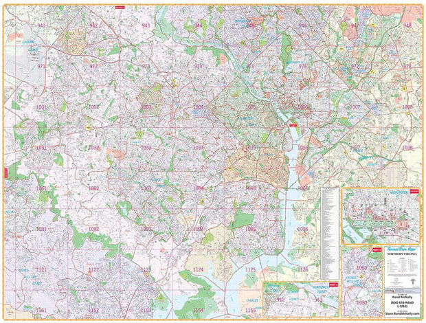
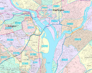
Washington DC & Northern Virginia by Rand McNally
DCWM100
Regular price
$229.00
Rand McNally's wall map of Northern Virginia/Washington, D.C. is ideal for anyone needing a comprehensive representation of the region for planning, routing, or reference. It's a great choice for business and sales strategy, urban development, social work outreach, education, and marketing.
D.C.-area residents, businesses, and government offices are sure to find this wonderful reference tool irreplaceable.
Note: This map is not available for gift wrapping. Please allow 7-10 days for shipping.
Laminated wall map printed with UV-resistant ink to help prevent color fading
Map details include airports, hospitals, railroads, points of interest, shopping centers, parks, golf and country clubs, post offices, police and fire stations, schools and educational institutions, government buildings, mileage circles, block numbers, city limits and annexations, ZIP codes and boundaries, and much more
Includes a separate street index book
Hanging kit with rails for easy mounting
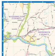
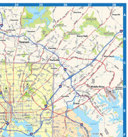
Coverage Area
Coverage area extends:
North to the Fairfax/Montgomery County line
South to Mason Neck State Park
East to the Capital Beltway, including New Carrolton and Glenarden
West to Manassas and Manassas Park in Prince Williams County, includes
Product Details
Dimensions: 79" x 60"
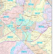
Colorcast Zip Code Style Wall Map of Washington, DC by Market Maps
DCWM103CC-1
Regular price
$118.75
Save money on our full line of wall maps from one of the industry leaders in wall maps. These always up to date, eye catching wall maps come in a variety of sizes and finishing options sure to meet your specific mapping needs.