

EDUC031
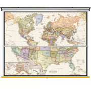
Perfect for home, business, or school, this Legacy USA Wall Map combines warm, attractive colors with high-detailed cartography. Details on this United States Wall Map include state boundaries and capitals along with other major cities and towns; major physical features such as mountain ranges and major mountain peaks; major water features such as oceans, seas, gulfs, and rivers; the Interstate highway system and other major roads; and all National Parks as well as other large National Park Service sites. Special features include traditional, blue-colored oceans and a white decorative border.
Spring Roller - Set
We know finding the perfect spring roller can be a difficult task. With all the options it can be overwhelming to find the perfect match. With our new sping roller sets, you no longer have to worry about finding your one true map.
Each map will be laminated then loaded on the spring roller. The map in the back will have a pulldown bar and ring. The map in the front will have a white plastic flip bar. Pull down both maps using the pulldown bar to view the front map. To view the back map, you can flip the front map over the back of the spring roller using the flip bar.
This price includes Button Mounting Brackets to help with hanging and installation once received!
EDUC030
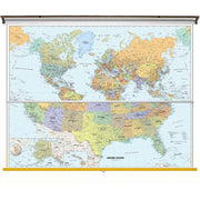
Perfect for home, business, or school, this Classic USA Wall Map combines warm, attractive colors with high-detailed cartography. Details on this United States Wall Map include state boundaries and capitals along with other major cities and towns; major physical features such as mountain ranges and major mountain peaks; major water features such as oceans, seas, gulfs, and rivers; the Interstate highway system and other major roads; and all National Parks as well as other large National Park Service sites. Special features include traditional, blue-colored oceans and a white decorative border.
Spring Roller - Set
We know finding the perfect spring roller can be a difficult task. With all the options it can be overwhelming to find the perfect match. With our new sping roller sets, you no longer have to worry about finding your one true map.
Each map will be laminated then loaded on the spring roller. The map in the back will have a pulldown bar and ring. The map in the front will have a white plastic flip bar. Pull down both maps using the pulldown bar to view the front map. To view the back map, you can flip the front map over the back of the spring roller using the flip bar.
This price includes Button Mounting Brackets to help with hanging and installation once received!
EDUC033
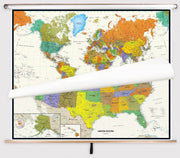
Perfect for home, business, or school, this Contemporary USA Wall Map combines warm, attractive colors with high-detailed cartography. Details on this United States Wall Map include state boundaries and capitals along with other major cities and towns; major physical features such as mountain ranges and major mountain peaks; major water features such as oceans, seas, gulfs, and rivers; the Interstate highway system and other major roads; and all National Parks as well as other large National Park Service sites. Special features include traditional, blue-colored oceans and a white decorative border.
Spring Roller - Set
We know finding the perfect spring roller can be a difficult task. With all the options it can be overwhelming to find the perfect match. With our new sping roller sets, you no longer have to worry about finding your one true map.
Each map will be laminated then loaded on the spring roller. The map in the back will have a pulldown bar and ring. The map in the front will have a white plastic flip bar. Pull down both maps using the pulldown bar to view the front map. To view the back map, you can flip the front map over the back of the spring roller using the flip bar.
This price includes Button Mounting Brackets to help with hanging and installation once received!
EDUC032
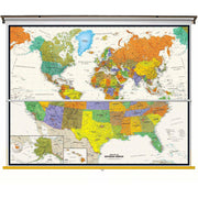
Perfect for home, business, or school, this Contemporary USA Wall Map - Spanish Version combines warm, attractive colors with high-detailed cartography. Details on this United States Wall Map include state boundaries and capitals along with other major cities and towns; major physical features such as mountain ranges and major mountain peaks; major water features such as oceans, seas, gulfs, and rivers; the Interstate highway system and other major roads; and all National Parks as well as other large National Park Service sites. Special features include traditional, blue-colored oceans and a white decorative border.
Perfecto para el hogar, negocio o escuela, este Mapa mural contempor?neo espa-ol en EE.UU., combina atractivos colores brillantes con la cartografÍa detallada de alta. Los detalles sobre este Mapa de Estados Unidos incluyen: las fronteras estatales y capitales, junto con otras ciudades y pueblos grandes; las principales caracterÍsticas fÍsicas, tales como cadenas monta-osas y los principales picos de las monta-as; principales caracterÍsticas del agua como oc-anos, mares, golfos, y rÍos; el sistema de autopistas interestatales y otras carreteras principales; y todos los parques nacionales, asÍ como otros sitios del Servicio de Parque Nacional de gran tama-o. Las caracterÍsticas especiales incluyen los oc-anos de color marfil y un borde decorativo negro.
Spring Roller - Set
We know finding the perfect spring roller can be a difficult task. With all the options it can be overwhelming to find the perfect match. With our new sping roller sets, you no longer have to worry about finding your one true map.
Each map will be laminated then loaded on the spring roller. The map in the back will have a pulldown bar and ring. The map in the front will have a white plastic flip bar. Pull down both maps using the pulldown bar to view the front map. To view the back map, you can flip the front map over the back of the spring roller using the flip bar.
This price includes Button Mounting Brackets to help with hanging and installation once received!
EDUC038
Map Order
1. United States
2. World
Hanging hardware will be included with your map to ensure you have all the pieces to install once you receive your order!
The Beginner wall map series by Kappa Map Group is an exceptional educational resource tailored for grades K-3. Even simpler than the Primary series, the US map shows color-coded states, state capitals, time zones, and state flags while the world map shows color-coded continents, national boundaries, and insets of the north & south polar regions.
Size: 63" x 54"
EDUC039
Map Order
1. United States
2. World
Hanging hardware will be included with your map to ensure you have all the pieces to install once you receive your order!
The Primary Wall Map series by Kappa Map Group is an ideal educational resource tailored for early learners in grades K-3, providing essential geographical knowledge in an accessible and easy-to-understand format. These maps feature vibrant color-coded countries, ensuring clear identification of political boundaries, and are designed with an emphasis on legibility and clarity. The series includes a range of valuable features, including:
These maps are designed to provide students and educators with an accessible and informative tool for exploring the world's geography, making them invaluable resources for classroom settings.
Target Grade Range: K through 3
Size: 63" x 54"
EDUC034
Map Order
1. North America
2. South America
3. Central America/ The Caribbean
Hanging hardware will be included with your map to ensure you have all the pieces to install once you receive your order!
The Primary Wall Map series by Kappa Map Group is an ideal educational resource tailored for early learners in grades K-3, providing essential geographical knowledge in an accessible and easy-to-understand format. These maps feature vibrant color-coded countries, ensuring clear identification of political boundaries, and are designed with an emphasis on legibility and clarity. The series includes a range of valuable features, including:
These maps are designed to provide students and educators with an accessible and informative tool for exploring the world's geography, making them invaluable resources for classroom settings.
Target Grade Range: K through 3
Size: 54" x 59"
EDUC035
Map Order
1. Europe
2. Africa
3. Asia
Hanging hardware will be included with your map to ensure you have all the pieces to install once you receive your order!
The Primary Wall Map series by Kappa Map Group is an ideal educational resource tailored for early learners in grades K-3, providing essential geographical knowledge in an accessible and easy-to-understand format. These maps feature vibrant color-coded countries, ensuring clear identification of political boundaries, and are designed with an emphasis on legibility and clarity. The series includes a range of valuable features, including:
These maps are designed to provide students and educators with an accessible and informative tool for exploring the world's geography, making them invaluable resources for classroom settings.
Target Grade Range: K through 3
Size: 54" x 59"
EDUC036
Map Order
1. North America
2. South America
3. Europe
4. Africa
5. Asia
Hanging hardware will be included with your map to ensure you have all the pieces to install once you receive your order!
The Primary Wall Map series by Kappa Map Group is an ideal educational resource tailored for early learners in grades K-3, providing essential geographical knowledge in an accessible and easy-to-understand format. These maps feature vibrant color-coded countries, ensuring clear identification of political boundaries, and are designed with an emphasis on legibility and clarity. The series includes a range of valuable features, including:
These maps are designed to provide students and educators with an accessible and informative tool for exploring the world's geography, making them invaluable resources for classroom settings.
Target Grade Range: K through 3
Size: 54" x 69"
EDUC037
Map Order
1. North America
2. South America
3. Europe
4. Africa
5. Asia
6. Australia
7. Antarctica
Hanging hardware will be included with your map to ensure you have all the pieces to install once you receive your order!
The Primary Wall Map series by Kappa Map Group is an ideal educational resource tailored for early learners in grades K-3, providing essential geographical knowledge in an accessible and easy-to-understand format. These maps feature vibrant color-coded countries, ensuring clear identification of political boundaries, and are designed with an emphasis on legibility and clarity. The series includes a range of valuable features, including:
These maps are designed to provide students and educators with an accessible and informative tool for exploring the world's geography, making them invaluable resources for classroom settings.
Target Grade Range: K through 3
Size: 54" x 69"
EDUC042
Map Order
1. United States
2. World
Hanging hardware will be included with your map to ensure you have all the pieces to install once you receive your order!
The Advanced Physical Wall Map series by Kappa Map Group offers an immersive and detailed exploration of the world's geography, making it an ideal resource for grades 9-12. These maps are a testament to precision and visual clarity, featuring shaded relief that brings to life the intricate contours of the planet's landscapes. The inclusion of a color ramp depicting elevation changes adds depth to the terrain, while an elevation profile provides an in-depth look at the topographical variations. This comprehensive collection of maps enriches the educational experience, providing students and educators with valuable insights into the physical geography of the world.
The US map includes four informative insets further enrich the maps, covering:
Within these maps, one can easily discern:
This combination of features makes these maps invaluable resources for anyone seeking to delve into the intricacies of the world's physical geography.
Target Grade Range: 9 through 12
Size: 63" x 57"
EDUC043
Map Order
1. United States
2. World
Hanging hardware will be included with your map to ensure you have all the pieces to install once you receive your order!
The Advanced Political Wall Map series by Kappa Map Group is an exceptional educational resource tailored for grades 9-12, providing a comprehensive exploration of global political landscapes. These maps feature vibrant color-coded countries, ensuring clear identification of political boundaries. Moreover, the series offers a wealth of information through four thematic insets:
Within these maps, you'll find:
Furthermore, the inclusion of shaded relief adds depth to the representation of landscapes, making the maps not only informative but visually engaging. The Advanced Political Wall Map series is an invaluable tool for educators and students seeking a deeper understanding of global political dynamics and geography.
Target Grade Range: 9 through 12
Size: 63" x 54" (full height)
EDUC040
Map Order
1. North America
2. South America
3. Europe
4. Africa
5. Asia
Hanging hardware will be included with your map to ensure you have all the pieces to install once you receive your order!
The Advanced Physical Wall Map series by Kappa Map Group offers an immersive and detailed exploration of the world's geography, making it an ideal resource for grades 9-12. These maps are a testament to precision and visual clarity, featuring shaded relief that brings to life the intricate contours of the planet's landscapes. The inclusion of a color ramp depicting elevation changes adds depth to the terrain, while an elevation profile provides an in-depth look at the topographical variations. This comprehensive collection of maps enriches the educational experience, providing students and educators with valuable insights into the physical geography of the world.
The US map includes four informative insets further enrich the maps, covering:
Within these maps, one can easily discern:
This combination of features makes these maps invaluable resources for anyone seeking to delve into the intricacies of the world's physical geography.
Target Grade Range: 9 through 12
Size: 63" x 59"
EDUC041
Map Order
1. North America
2. South America
3. Europe
4. Africa
5. Asia
6. Australia
7. Antarctica
Hanging hardware will be included with your map to ensure you have all the pieces to install once you receive your order!
The Advanced Physical Wall Map series by Kappa Map Group offers an immersive and detailed exploration of the world's geography, making it an ideal resource for grades 9-12. These maps are a testament to precision and visual clarity, featuring shaded relief that brings to life the intricate contours of the planet's landscapes. The inclusion of a color ramp depicting elevation changes adds depth to the terrain, while an elevation profile provides an in-depth look at the topographical variations. This comprehensive collection of maps enriches the educational experience, providing students and educators with valuable insights into the physical geography of the world.
The US map includes four informative insets further enrich the maps, covering:
Within these maps, one can easily discern:
This combination of features makes these maps invaluable resources for anyone seeking to delve into the intricacies of the world's physical geography.
Target Grade Range: 9 through 12
Size: 63" x 59"

