

PAWM104
This map of Philadelphia shows ZIP code areas overlaid on a road map. Ideal for planning of deliveries, home services, sales territories, real estate and much more. Base map features include all roads with major roads and highways labelled; neighborhood names; railways; and high level land use such as parks and recreation areas, industrial areas and hospital campuses.
This map is rolled and shipped in a sturdy cardboard tube.
PAWM103
This map of Philadelphia County, Pennsylvania shows street level information including street labeling. Base map features include all roads with major roads and highways labelled; neighborhood names; railways; high level land use such as parks and recreation areas, industrial areas and hospital campuses; and a variety of points of interest including libraries, stadiums, museums, border crossings and more. ZIP code boundaries are shown as a secondary map feature.
This map is rolled and shipped in a sturdy cardboard tube.
PAWM006CC-1
The Color Cast Style Pennsylvania State Map is a multi-colored display that shades each county with its own background color. It is an ideal choice for applications that benefit from quickly and easily distinguishing one county from the others.
This wall map comes laminated on both sides using 3mm hot lamination, which protects your wall map and allows you to write on it with dry-erase markers.
Includes inset maps of all major cities.
Features include:
This map is rolled and shipped in a sturdy cardboard tube.
PAWM107
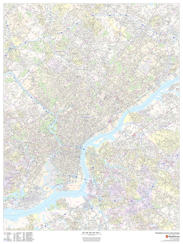
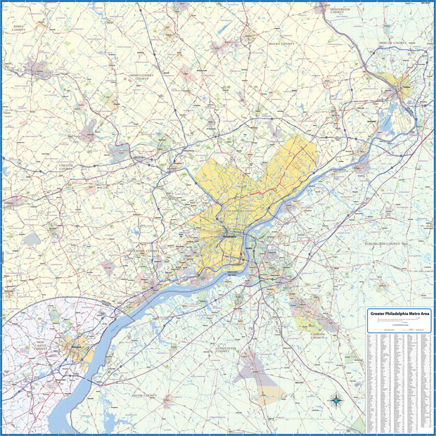
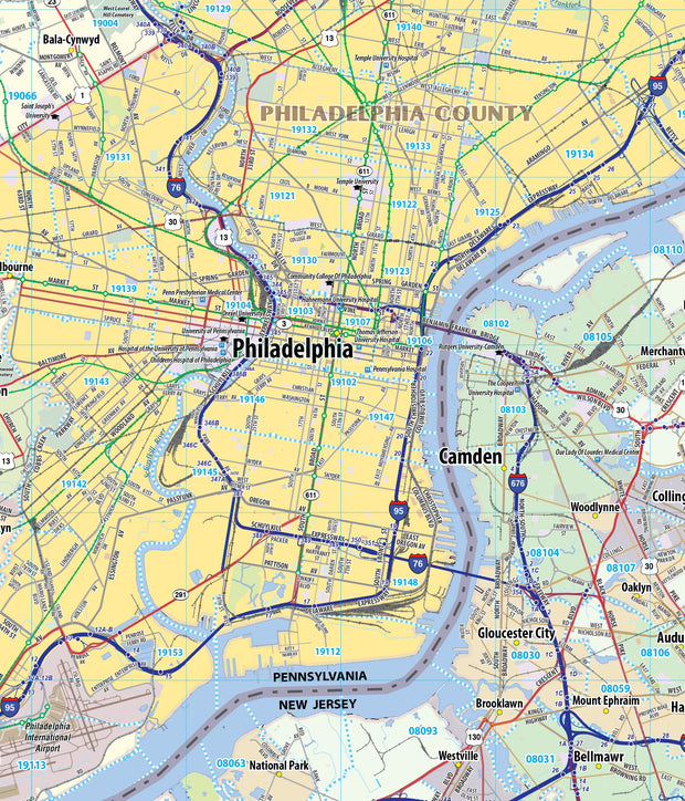
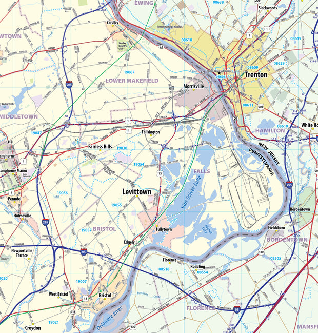
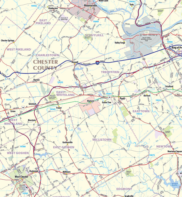
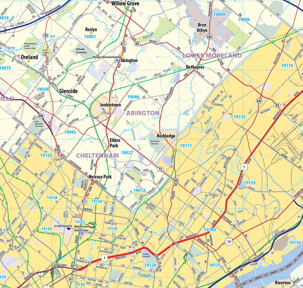
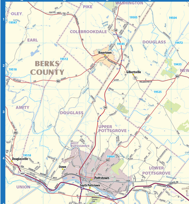
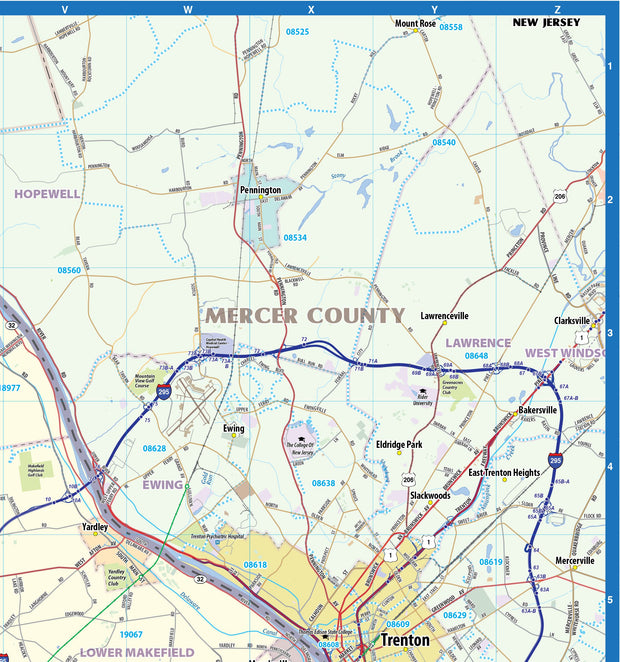
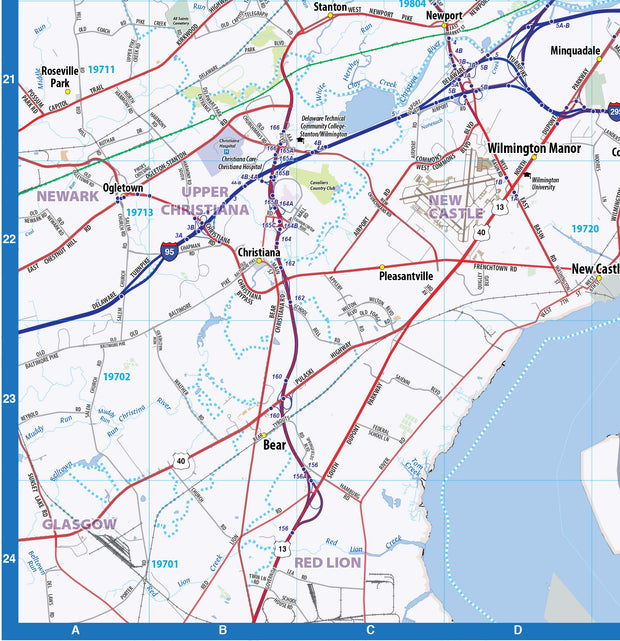
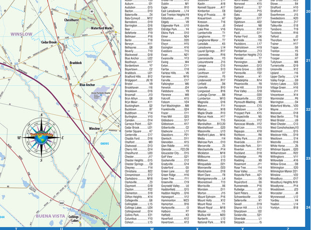
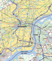
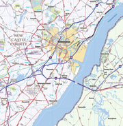
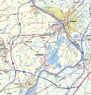
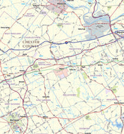
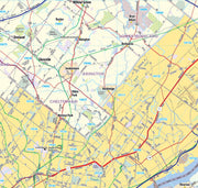
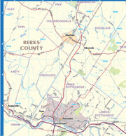
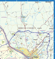
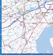
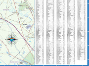
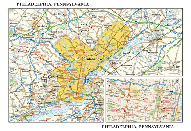
Wall map of the Greater Philadelphia metro area showing locations within 25 miles of downtown Philadelphia, including Delaware County, Wilmington, Camden, Trenton, and adjacent areas of Montgomery County, Chester County, Bucks County, Burlington County, and Gloucester County. Features shown include cities, towns, major roads and highways, zip codes, and major points of interest. An index of community names is included.
This map is rolled and shipped in a sturdy cardboard tube.
PAWM102
This detailed reference map combines two maps in one - a map of the greater Philadelphia area plus a street-level map of historic, downtown Philadelphia. The metropolitan map shows the area's cities and towns, highways and roads, and a variety of points of interest. The map includes the surrounding suburban cities in Pennsylvania and New Jersey. The downtown map, which includes Independence National Historical Park, shows highways, streets, parks, landmarks, and other points of interest. Society Hill and Chinatown are among the neighborhoods featured on this map.
This map is rolled and shipped in a sturdy cardboard tube.